Planet Labs indefinitely withholds Iran war imagery after US request
Washington: US-based satellite imaging company Planet Labs has announced that it will indefinitely withhold imagery of Iran and the wider conflict zone in West Asia following a request from the US government, according to a Reuters report. In an email to customers, the company said it would “voluntarily implement an indefinite withhold” of imagery within … Get the latest updates in Hyderabad City News , Technology , Entertainment , Sports , Politics and Top Stories on WhatsApp & Telegram by subscribing to our channels. You can also download our app for Android and iOS .
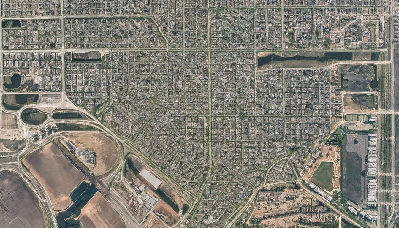
Washington-based satellite imaging company Planet Labs has announced that it will indefinitely withhold imagery of Iran and the wider conflict zone in West Asia following a request from the US government. According to a Reuters report, the company shared this decision in an email to customers, stating that it would "voluntarily implement an indefinite withhold" of imagery within a designated Area of Interest due to the conflict. This policy, which was applied retroactively from March 9, 2026, introduces a managed access system for newly captured data.
Under the new policy, imagery will not be released in real time and will instead be distributed selectively, including for urgent, mission-critical requirements or where it serves the public interest. The company emphasized that this approach is in line with policies followed by other remote sensing firms during periods of heightened geopolitical sensitivity.
This move builds on earlier restrictions imposed by Planet Labs. The company had first introduced a 96-hour delay on West Asia imagery, later extending it to 14 days last month, citing concerns that such data could be used by adversaries to target US and allied forces. The ongoing conflict in West Asia began on February 28 after joint US-Israeli strikes on Iran. Since then, the war has caused significant casualties and disrupted global energy markets, underscoring the strategic importance of satellite imagery during active conflicts.
Planet Labs clarified that access to imagery outside the designated region remains unaffected and noted that it will continue to review the situation closely. The company's decision to withhold imagery follows a pattern of increased collaboration between private companies and governments during times of geopolitical tension.
The US government's request to withhold imagery raises questions about the balance between national security and the availability of information. Satellite imagery has been a critical tool for journalists, researchers, and humanitarian organizations in documenting conflicts and their impacts. By restricting access to this data, Planet Labs is effectively limiting the ability of these groups to monitor the situation on the ground.
Critics argue that such restrictions can lead to a lack of transparency and hinder efforts to hold those responsible for war crimes accountable. They also question whether the US government's concerns about adversaries gaining access to satellite imagery outweigh the potential harm caused by limiting the information available to the public and international organizations.
On the other hand, supporters of the decision argue that it is necessary to protect national security interests and prevent the use of satellite imagery by hostile actors. They contend that the managed access system introduced by Planet Labs allows for a more controlled distribution of data, ensuring that it is used responsibly and for legitimate purposes.
The ongoing conflict in West Asia has highlighted the complex role of satellite imagery in modern warfare. As the situation continues to evolve, it remains to be seen how Planet Labs' decision will impact the flow of information and the ability of the international community to respond effectively to the crisis.