Image: NISAR views Mount St. Helens
This image captured by U.S.-Indian Earth satellite NISAR on Nov. 10, 2025, shows Washington's Mount St. Helens. The image is cropped from a much larger swath spanning the Pacific Northwest on a cloudy day; NISAR's L-band SAR instrument is able to peer through the clouds at the surface below.
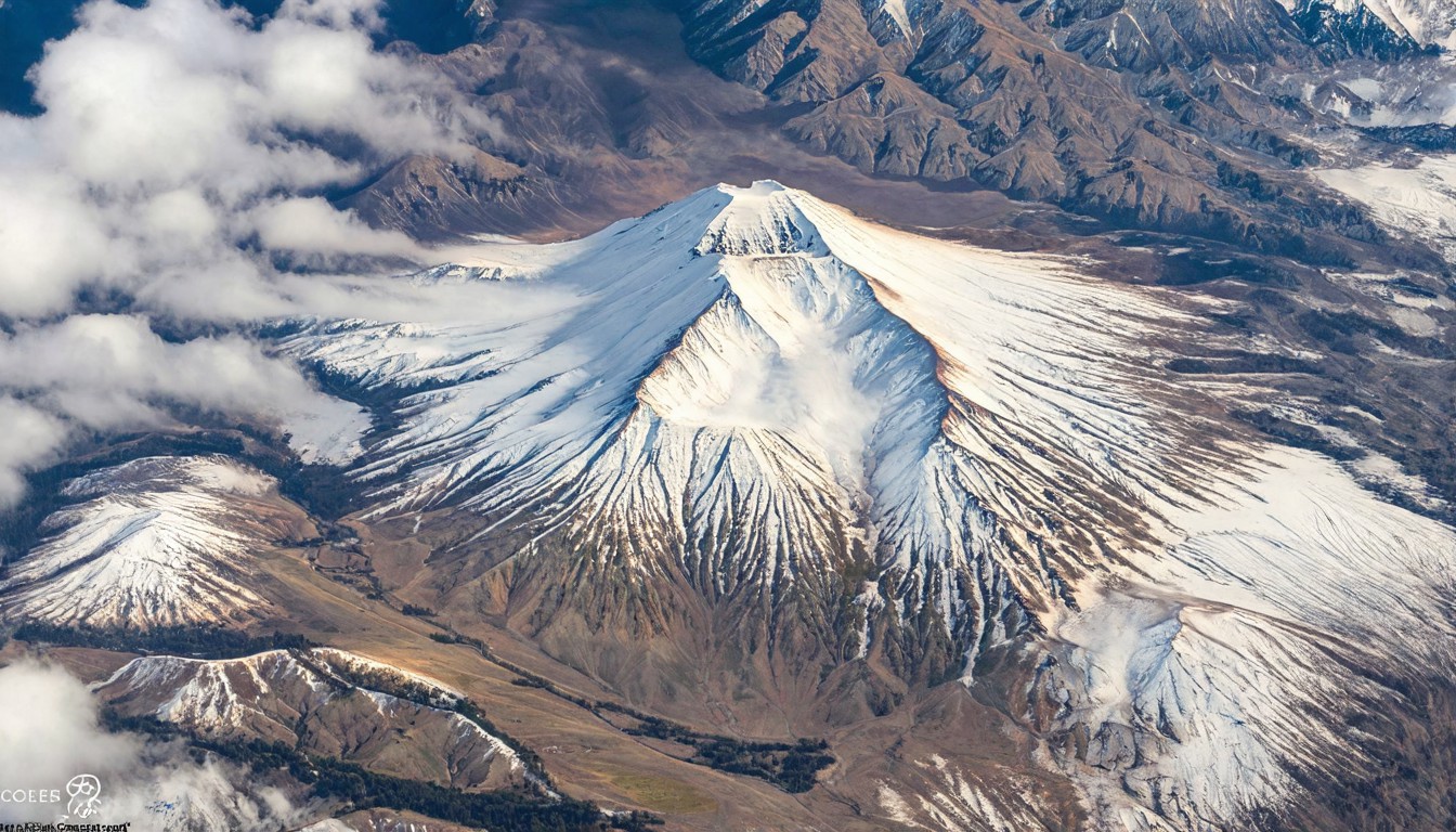
On November 10, 2025, the U.S.-Indian Earth satellite NISAR captured a striking image of Mount St. Helens in Washington state. This image, which is a cropped portion of a much larger swath spanning the Pacific Northwest, was taken on a cloudy day. What makes this image particularly remarkable is that NISAR's L-band Synthetic Aperture Radar (SAR) instrument was able to penetrate the clouds and reveal the surface below.
NISAR, short for NASA's Interferometric Synthetic Aperture Radar, is a joint mission between NASA and the Indian Space Research Organisation (ISRO). Launched in 2021, NISAR's primary mission is to provide high-resolution, radar-based imaging of Earth's surface, particularly in areas that are difficult to observe using traditional optical sensors. The satellite's L-band SAR instrument is designed to operate at a wavelength of about 26 centimeters, which allows it to penetrate cloud cover and provide detailed information about the landscape beneath.
Mount St. Helens, a stratovolcano in the Cascade Range, is best known for its catastrophic eruption in 1980, which resulted in the deaths of 57 people and caused widespread destruction. Since then, the volcano has been closely monitored by scientists, who have studied its recovery and ongoing activity. The NISAR image captures the mountain on a day when clouds obscured much of the region, yet the satellite's advanced technology was still able to reveal the volcanic terrain.
The image highlights the capabilities of NISAR's L-band SAR instrument, which is capable of producing radar images with a resolution of up to 15 meters. This level of detail allows scientists to study changes in the Earth's surface with unprecedented accuracy, even in the presence of cloud cover. The ability to peer through clouds is particularly valuable for monitoring areas prone to natural disasters, such as volcanic regions, as well as for assessing deforestation, landslides, and other environmental changes.
In addition to its scientific benefits, the NISAR mission also represents a significant collaboration between NASA and ISRO. The partnership has been instrumental in advancing Earth observation technologies and fostering international cooperation in space exploration. The successful capture of Mount St. Helens through the clouds underscores the potential of this joint mission to provide critical data for a wide range of applications, from disaster management to environmental monitoring.
The image of Mount St. Helens captured by NISAR on November 10, 2025, serves as a testament to the power of advanced satellite technology. By overcoming the challenges posed by cloud cover, the L-band SAR instrument has provided a clear view of the volcanic landscape, offering valuable insights for scientists and researchers. As NISAR continues its mission, it will undoubtedly contribute to a deeper understanding of our planet and the dynamic processes that shape it.